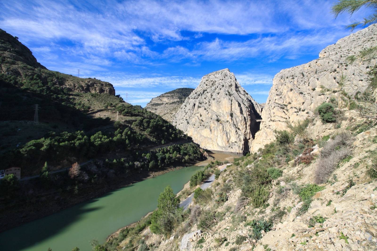
Caminito del Rey Route: Length, Walking Time, Sections and What to Bring
The Caminito del Rey is a one-way, linear walk from north to south: you start in Ardales, by the Conde de Guadalhorce reservoir, and finish at El Chorro in the municipality of Álora. The operator’s own figures put the full length at 7.7 km, of which about 2.9 km is the controlled section between the two boardwalk gates (1,550 m of boardwalk and 1,405 m of trail through the Valle del Hoyo) and the rest is access and exit paths. Allow three to four hours from the road to the end, of which about 150 minutes is spent inside the gorge itself. It is mostly downhill, with a height difference of roughly 150 m from start to finish, but there are climbs and flights of steps along the way.
This guide walks the route in order, section by section, using the distance markers engraved on the boardwalk, and ends with what to wear and what you are allowed to carry. For booking, see the tickets guide; for the walk in from the car parks and the bus, see the north access guide.
The route at a glance
| Direction | One way, north (Ardales) to south (El Chorro, Álora) |
| Full length, road to bus | 7.7 km (operator’s FAQ); the route page rounds it to 8 km |
| Controlled section, gate to gate | 2,955 m: 1,550 m boardwalk, 1,405 m trail |
| Total time | Three to four hours |
| Inside the gorge | About 150 minutes |
| Height difference | About 150 m, mostly downhill |
| Hanging bridges | The original, 35 m long and anchored 105 m up; a new 110 m bridge (since 10 June 2026), at most 50 m up |
| Toilets | At the entrance ticket office; none inside |
| Return | Shuttle bus from El Chorro, €2.50, cash |
Why the distance figures do not agree
Read three pages about the Caminito and you will see three different lengths. They are all correct; they just measure different things.
- 2,955 m is the operator’s distance between the entrance and exit gates of the controlled section: 1,550 m of boardwalk and 1,405 m of trail or forest track.
- 2.9 km is the same stretch, rounded, in the operator’s FAQ.
- 3200 m is the number on the last distance marker at the southern gate. The markers count from the start of the boardwalk and include the stairs and detours.
- 3.52 km is the central part of the route with no vehicle access, from the operator’s risk-information document.
- 5.4 km is the shortest version of the whole walk, from the road to the return bus, using the shorter access path.
- 7.7 km is the full length with the longer access and exit paths, from the operator’s FAQ; the route page rounds it to 8 km.
If you are deciding whether you can manage it, use the 5.4 km to 7.7 km range: that is what your legs will actually do, depending on which access path you take.
Before the gate: the two ways in
The boardwalks do not start at the road. From the El Kiosko restaurant area on the reservoir you walk downhill to a control booth at the old Gaitanejo hydroelectric plant, where the controlled route begins. There are two paths.
| Access | Length | Time | What it is like |
|---|---|---|---|
| Access 2: pedestrian tunnel | 1.5 km | About 20 to 25 minutes | A 150 m tunnel, then a narrow path joining the Gaitanejo service track down to the dam |
| Access 1: Gaitanejo trail | 2.7 km | About 35 minutes | Starts at the Túnel Grande beside El Kiosko; a forest path down to river level |
The operator’s compulsory rules put the gate a 25-minute walk by the shortest route from El Kiosko, and ask you to be there 30 minutes before your time slot. The longer trail passes the ruins of cave houses and the tafoni, a rounded hollow in the sandstone wrongly called the “Gothic Arch”, so it is worth taking if you have time. The north access guide covers parking, the shuttle and which path to choose.
The control booth
At the booth beside the Gaitanejo dam your ticket and ID are checked, your footwear is looked at, and banned items are stopped: umbrellas, hiking sticks and selfie sticks among them. You are handed a helmet, which you wear for the whole route and hand back at El Chorro. Visitors are then grouped by time slot, and groups set off every 10 minutes. There are toilets here (the entrance ticket office has 8 unisex cubicles) and there are none again until the exit, so use them.
From the booth to the start of the boardwalk is about 10 minutes on foot, past a small viewpoint over the dam and down a few steps.
Section 1: the Gaitanejo gorge
The first gorge arrives almost at once. The Gaitanejo gorge is not even 10 m wide from wall to wall, and the boardwalk is bolted to its side above the river. This is where most people have their first real look down. Floor boards carry the distance walked: a marker every 50 m as far as the Rocas Llanas viewpoint.
Near the start is a marble plaque recording the reopening. It says 26 March, but the walk actually reopened on 28 March 2015: a three-day mourning period after the Germanwings air crash that week postponed the ceremony by two days, and the plaque had already been carved. Look down, too, and you will see the old concrete path below the new one, still clinging to the rock. The whole restoration took less than a year.
Section 2: El Soto and the Tajo de las Palomas
Between the first and second gorges the walls open out into a small area called El Soto, where the boardwalk drops down to river level by a short, steep flight of wavy concrete steps. On the far bank runs the Málaga to Córdoba railway, which you will follow, on and off, for the rest of the walk.
The second gorge, the Tajo de las Palomas, has two landmarks worth stopping for:
- The Puente del Rey (700 m marker). A small concrete bridge across the river; King Alfonso XIII crossed it in 1921, which is where the walk’s name comes from.
- The Rocas Llanas viewpoint (900 m marker). A landing reached by a short ladder, with a view south into the Valle del Hoyo and up to the orange-stained wall of the Tajo de Ballesteros, where vultures nest.
Section 3: the Valle del Hoyo
At about the 910 m mark the walls fall back and the river slows. The middle of the walk is not boardwalk at all but a dirt and gravel trail through pines, carob trees and scrub along the line of an old water canal. Markers here are every 100 m. This is the easiest walking on the route and the part with shade.
- Sapito Pintojo pond (1380 m). A shaded spot with carob trees and two sets of benches. The operator itself suggests resting here for a few minutes, drinking and eating something, because there is still a long way to go.
- Casa del Hoyo (2100 m). The ruins of a small farmhouse in the middle of the valley.
- The canal aqueduct. At the end of the valley a 35 m aqueduct bridge of 1904 crosses between walls about 300 m high.
You must stay on the path in the Valle del Hoyo: leaving it in any direction is prohibited, because of the risk of landslides. On days of rain or wind when rocks are falling, staff can send visitors through a 300 m section of the old canal tunnel, restored, lit and reopened in 2017, instead of the open path, so the route does not have to close.
Section 4: the Gaitanes gorge
From the 2500 m marker the second set of boardwalks begins, and this is the part people come for. The operator describes it as the most overwhelming stretch of the route: an 800 m run of hanging boardwalk along the Gaitanes gorge, under walls 250 m tall and more than 100 m above the river. In places the new boardwalk runs just 1 m above the remains of the old path, so you can see exactly what earlier walkers were standing on.
Along this stretch you pass:
- The glass balcony (2690 m). A small glass-floored platform jutting from the boardwalk over the drop. A sign asks for no more than four people on it at once.
- The fossil beach (2750 m). A vertical wall of rippled limestone that was once a seabed, with an ammonite fossil under a protective cover.
- The memorial plaques. On a concrete area before the hanging bridge are plaques for people who died in accidents in the gorge before the 2015 restoration, placed there at their families’ request.
The hanging bridge (the original)
At the 2900 m marker you reach the hanging bridge: a metal walkway 35 m long, slung wall to wall and anchored 105 m up. The floor is a metal grid, so you can see straight through to the river. Before it opened in 2015 it was load-tested with up to 50,000 kg, which is worth remembering when it moves under you. Walkers keep to the right and keep moving.
This is the point that decides wind closures. The operator closes access when the wind is strong along the hanging bridge, so on a gusty day it is the bridge, not the rest of the route, that rules.
The new bridge (opened June 2026)
Since Wednesday 10 June 2026 there has been a second hanging bridge near the end of the route. It is 110 m long, at most 50 m above the ground, has a walking width of 1.2 m, and takes up to 30 people at once. It sits just before the area above the railway’s iron bridge and the El Chorro tunnel, and comes with 300 m of new trail.
The point of it is the finish. A study by the University of Granada found a high rockfall risk at the end of the trail and on the start of the old path down, and the new bridge saves almost a kilometre of steep downhill walking. The old final stretch has not been closed: the Diputación de Málaga says those who want it can still use it. If you are tired, hot, or not keen on loose descents, the new bridge is the easier finish.
The exit to El Chorro
After the last boardwalk you climb a set of stairs over the railway tunnel and leave through the southern gate, at the 3200 m marker. The old exit path from here to El Chorro is 2.1 km, with a short climb on steps and then a long descent round the hill. The operator’s timings are about 15 minutes from the boardwalk exit to the control booth where you return your helmet, and another 15 minutes from there to the railway station.
The shuttle bus stop is on the station platform. The bus takes about 15 to 20 minutes back to the El Kiosko area and costs €2.50 per person, paid in cash on board or added to your ticket online; one ticket covers as many trips as you need that day. On the consortium’s winter timetable (1 November 2026 to 31 March 2027) the last bus back up leaves El Chorro at 18:00 and reaches El Kiosko at 18:30 (the last one down leaves El Kiosko at 18:30 and reaches El Chorro at 19:00); the operator’s own pages quote slightly different hours, so check the timetable for your date in the north access guide.
The old path below
Everything you walk on today is a rebuild. The original Caminito del Rey was built between 1901 and 1905 as a service path for the hydroelectric works, linking the Gaitanejo dam with the El Chorro power station. It was about 3 km long and barely 1 m wide, fixed to the gorge walls around 100 m above the river, and for decades local people used it day and night (it had electric lighting) to reach school, shops and the railway. It became famous after King Alfonso XIII walked it in 1921, and infamous as it decayed. After fatal accidents in 1999 and 2000 it was closed, and it reopened, rebuilt above the old line, at the end of March 2015. The safety guide tells that story in more detail.
The route in words, north to south
- El Kiosko and the reservoir: start of both access paths.
- Access path: 1.5 km by the tunnel or 2.7 km by the Gaitanejo trail, downhill.
- Control booth at the Gaitanejo plant: ID check, helmets, groups every 10 minutes, toilets.
- 0 m: first boardwalk, Gaitanejo gorge, under 10 m wide.
- 700 m: Puente del Rey, in the Tajo de las Palomas.
- 900 m: Rocas Llanas viewpoint.
- 910 m to the aqueduct: Valle del Hoyo trail, shade, benches at 1380 m, ruins at 2100 m.
- 2500 m: second boardwalk begins, Gaitanes gorge.
- 2690 m: glass balcony.
- 2750 m: fossil beach.
- 2900 m: hanging bridge, 105 m up.
- New bridge: 110 m long, optional shorter finish since 10 June 2026.
- 3200 m: southern gate; exit path, helmet return, El Chorro station and bus.
How long each part takes
The operator’s own timings, added up, explain the three-to-four-hour total:
| Stretch | Time |
|---|---|
| Tunnel near El Kiosko to the control booth (longer trail) | 50 minutes |
| Control booth to the boardwalk entrance | 10 minutes |
| Boardwalk, Valle del Hoyo, boardwalk | 150 minutes |
| Boardwalk exit to the El Chorro control booth | 15 minutes |
| Control booth to the railway station | 15 minutes |
Fast walkers on the short tunnel path will be quicker; the operator’s FAQ puts the Caminito itself, gate to gate, at about 1.5 to 2 hours. But you cannot stop for long on the boardwalks, lunch is not allowed once you are on them, and people bunch at the viewpoints, so plan on the full range. The operator also asks visitors to allow for the remaining daylight in case the walk takes longer than expected, which matters on short winter days with a late slot.
What to wear
The footwear rule is enforced at the booth, and people do get turned away.
- Shoes: proper walking shoes or trainers with grip. Flip-flops, high heels and anything not secured to the foot at the back are strictly forbidden. The operator recommends hiking boots.
- Clothing: dress for the season. Clothing unsuitable for the weather, or that restricts movement, is against the rules. A thin layer helps on cool mornings in the gorge; in summer, light clothing and a hat that fits under the helmet.
- Rain: umbrellas are not allowed. If rain is forecast, a raincoat or similar is compulsory.
- The helmet: provided at the booth, worn throughout, returned at El Chorro.
What to bring, and what to leave behind
The operator’s list is short and specific:
- Water: at least 1.5 litres per person. There are vending machines at the start, but nothing inside the gorge.
- Snacks: chocolate, energy bars, nuts and fruit are the only food allowed. Eat a proper meal before or after.
- Sunscreen, especially in summer.
- ID: your ticket is personal and minors must show proof of age.
- A small bag: large backpacks and bags are prohibited, because they can push other walkers towards the rail.
Not allowed on the route: walking poles, canes and crutches; umbrellas; selfie sticks and tripods; drones; prams and pushchairs; pets, including guide dogs; alcohol. You may not clip a harness to the safety cable that runs along the walls.
Facilities and phone signal
There are no toilets between the entrance and the exit, and bins only at the control cabins at each end, so carry your rubbish out. Phone signal in the gorges is almost non-existent except on Vodafone. Staff patrol the route, cameras cover it, and the handrail clips carry a position code such as 102N or 54S that you can quote if you need help. In a serious incident with no staff nearby, call 112.
Walking it well
- Keep right. Walking on the right is a rule on the boardwalks, so faster people can pass on the inside.
- Do not stop on orange marks. Small orange marks on the handrails flag spots with a higher rockfall risk; keep moving through them.
- Use the valley. The Valle del Hoyo is the place to drink, eat a snack and rest; the boardwalks are not.
- Choose your slot. In summer an early slot avoids the worst of the heat; in winter a late slot leaves less daylight. The best time to visit guide covers months, heat and closures.
If you would rather have someone else handle the tickets and transport, guided options are compared on the tours page. For families, the Caminito del Rey with kids guide explains the age rule and how children cope with the route.